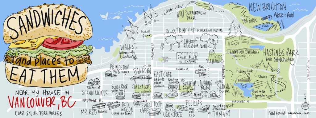
Illustration of an East Vancouver Sandwich Map
I live for sandwiches. So why not an illustration of an East Vancouver sandwich map? Happily, there’s no shortage of delicious options nearby. And good parks to eat them in, too.
The map includes the two neighbourhoods of Hastings-Sunrise and Grandview-Woodlands.
I’d like to give a big thanks to Uppercase magazine and the talented pair at They Draw and Travel for the contest for this map. They said, “draw a map of the creative and curious”.
As a self-employed illustrator, it’s always too easy to put everyone else’s artwork first – and leave my own art-making for last. This contest came at just the right time on a Friday that I went for a walk/snack, and drew this quickly to send in. A creative and curious way to end the week!

4 comments on “Illustration of an East Vancouver Sandwich Map”
This is fantastic! Would you mind if I put it on my East Village AirBnB page? With credit, of course.
Hi, of course! What’s a sandwich without sharing. Thanks for asking!
This is fantastic! Would you mind if I put it on my East Village AirBnB page? With credit, of course.
Hi, of course! What’s a sandwich without sharing. Thanks for asking!